We followed an old alignment of Route 66 extending west from Navajo, AZ, towards the Painted Desert. This view is to the southeast, with the interstate about a mile in the distance. 66:51
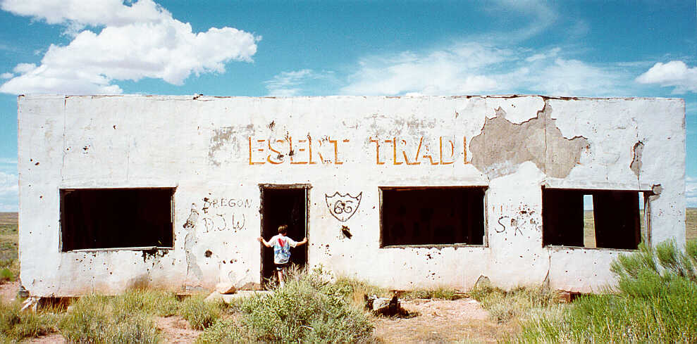
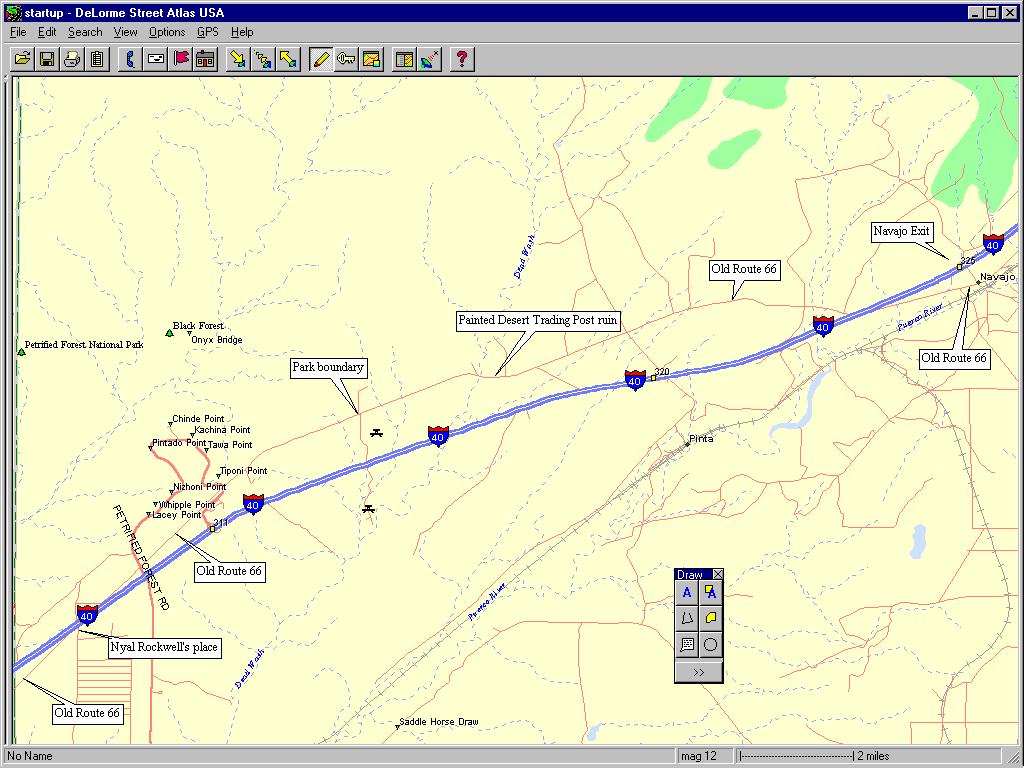
Ryan examined the ruins of the Painted Desert Trading Post. It rests on an old alignment of Route 66 that extends from Navajo, AZ, to the barricaded border of the Petrified Forest National Park. Route 66 originally passed through the park, and one can see both its path and the remaining pole-line from the park drive. Old Route 66 is also clearly depicted in Street Atlas version 4.
This building is falling down. My dad wouldn't let me go in because the roof was falling in. There was graffiti all over. 66:51
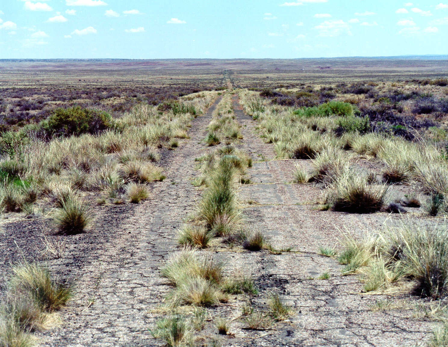
In 1999, Jim Ross, Ryan and I received permission to drive Route 66 within the Park boundary. Nothing unusual to see, just very interesting to be there with Jim and Ryan on an alignment of Route 66 normally uninhabited. This image is a view to the east. It is a thumbnail. If you click inside the picture, a larger version will appear. I include this larger version in case someone would like to study it. For example, one can see the Painted Desert Trading Post on the larger image, at pixel location H=1003, W=230. 66:51
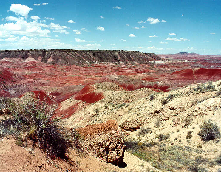
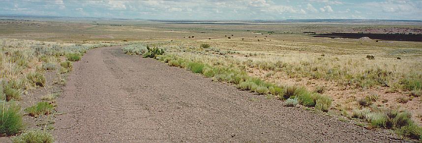
From our special vantage point on Route 66 inside the Park, we could see the mesa on which the Park itself rests. It is the darker, elevated portion in the upper left of the photo. Near the edge of the mesa is the Park drive. I am sure that some of the Park visitors could see us from the eastern overlooks and wondering what the heck we were doing. 66:51
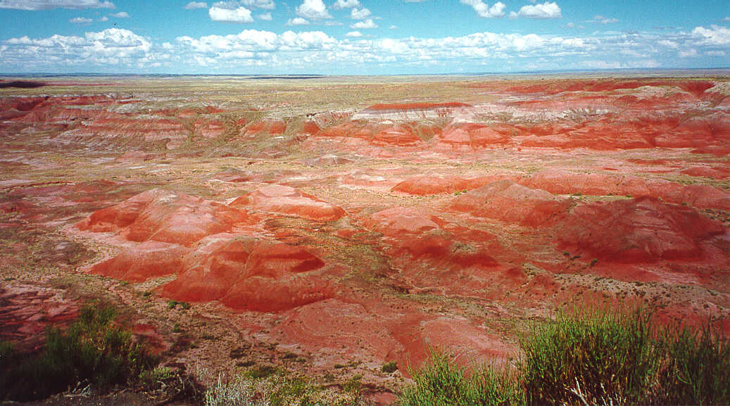
This is a view of the Painted Desert, Tiponi Point - magnificent. 66:51
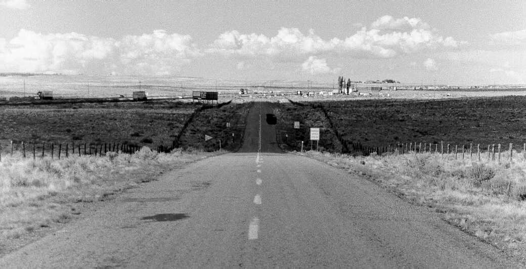
Looking east, we saw the end of Route 66 as it encounters the interstate. At that junction is Nyal Rockwell's place. Past the interstate, the pole-line and the path of Route 66 continues into the Petrified Forest National Park. On the right, one can see the overpass that carries Park Road over the interstate. 66:51
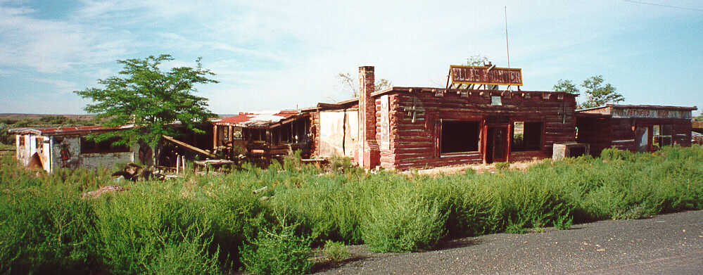
Ella's Trading Post rests a bit west of Joseph City, AZ, on old Route 66. 66:51
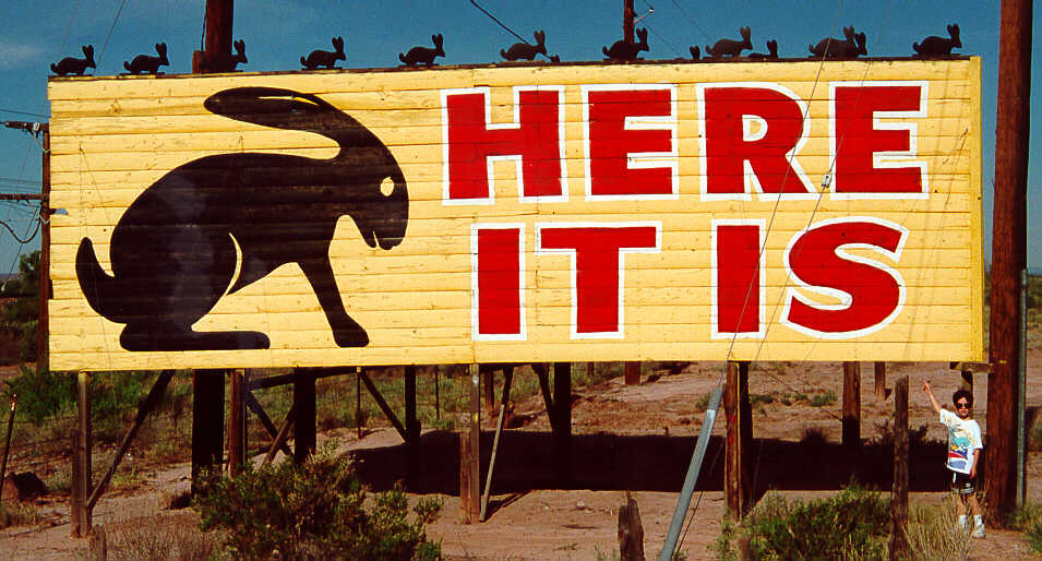
I wish that everyone could visit this place - Jackrabbit Trading Post - near Joseph City, AZ.
This place had the most variety of any store I have seen - from rocks to airplanes to shirts and coffee mugs and stuffed jackrabbits. 66:51
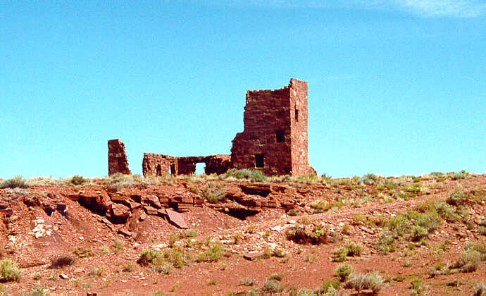
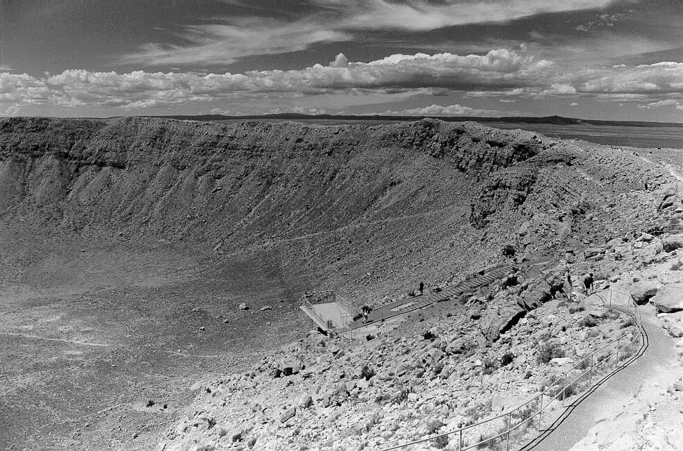
Perhaps every Route 66 Roadie has a "why I became interested in Route 66" story. Some years ago, on a visit to Meteor Crater, I asked at the nearby gas station / RV park about this structure. Some very friendy clerk told me that it was an old Route 66 attraction - an observatory for viewing Meteor Crater. I was hooked.
Immediately south of the gas station / RV park at the Meteor Crater exit is old Route 66. It extends eastward to this ruin, and westward to a sign informing us to stop. 66:51
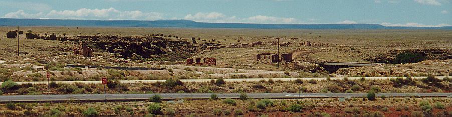
The ruins of Two Guns and Canyon Diablo are fenced off from the interstate access road. We could see several ruins as well as an old Route 66 bridge (just above the I-40 east-bound off-ramp extending horizontally through the photograph, taken from the I-40 overpass). 66:51
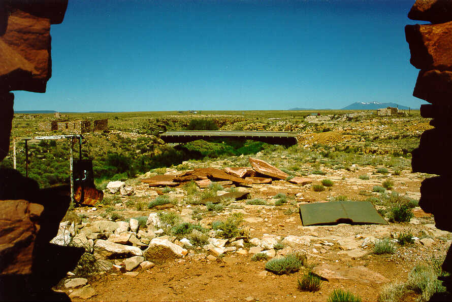
In 1998, we revisited Two Guns. We found that there is another access road into the area from the interstate, unblocked, so we explored. Two Guns is an amazing ruin: buildings, attractions, and rubble. In the exteme foreground of this photo is the doorway of a building. In the center is that Route 66 bridge with no roadway. Above it, one can see interstate traffic. Finally, on the right above a ruin, are the San Francisco Mountains with their snowy peaks. 66:51
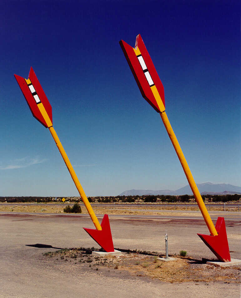
In 1999, we found the trading post at Twin Arrows back in operation. 66:51
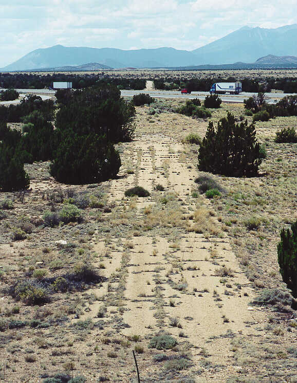
From the I-40 overpass that allows access to Twin Arrows, one can see the old alignment extending west-northwest across the Interstate.66:51
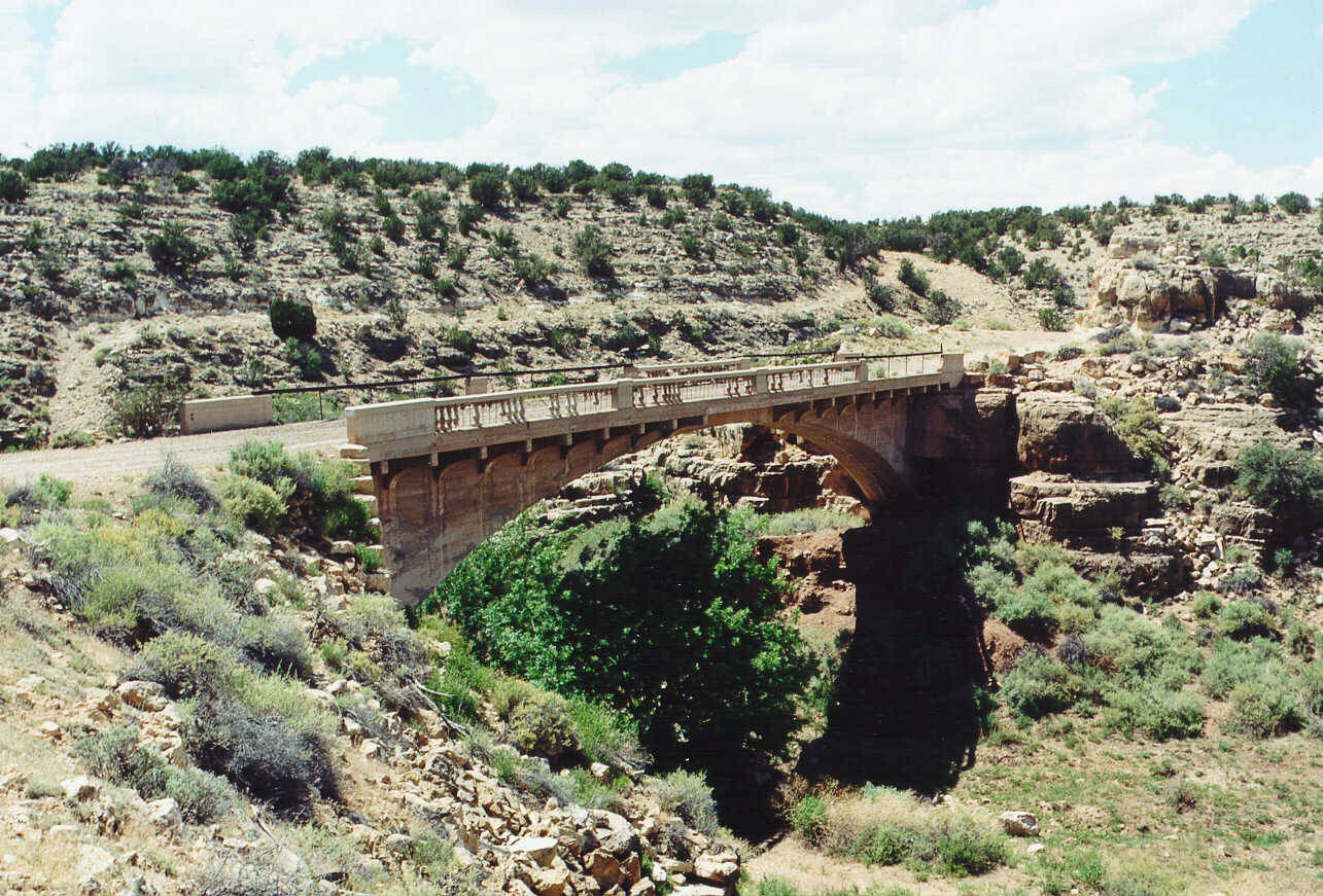
If you could follow the above alignment of old Route 66, you would soon find Padre Canyon Bridge, still standing, although a bit the worse for wear. If you cross this bridge, the old road continues to the I-40 exit at Winona. 66:51