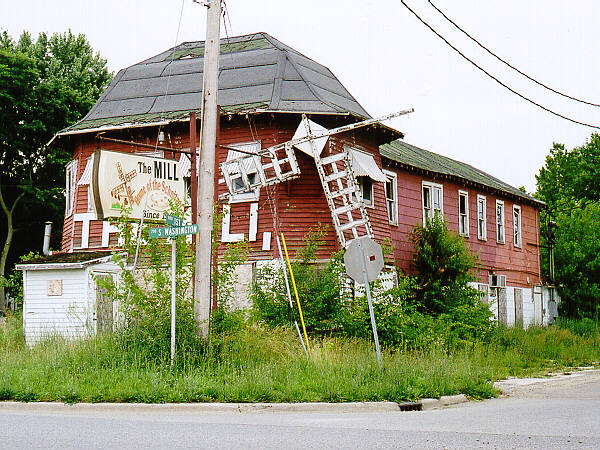
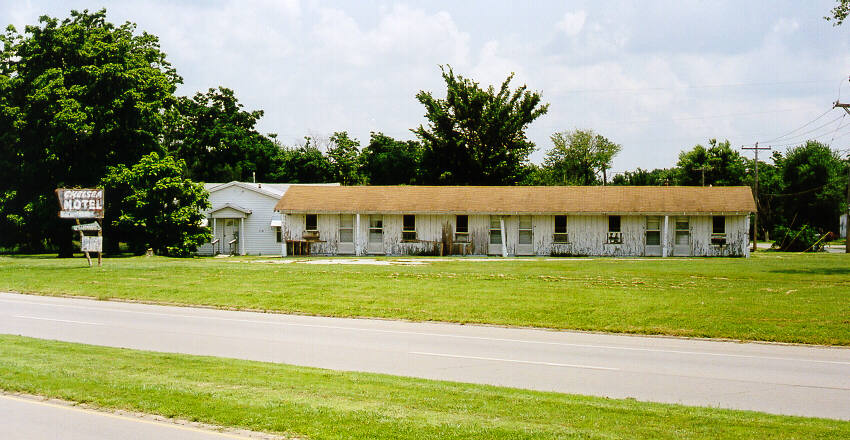
 At the intersection of First & South Washington, on an old alignment of 66 through Lincoln, IL, is this ruin. I would like to learn more about this place.
Here are some of the pictures and accounts of the 2002 Tour. The pictures shown on this page are thumbnails; a click on the thumbnail fetches the full sized version. You can return here by clicking on your browser's Back button.
At the intersection of First & South Washington, on an old alignment of 66 through Lincoln, IL, is this ruin. I would like to learn more about this place.
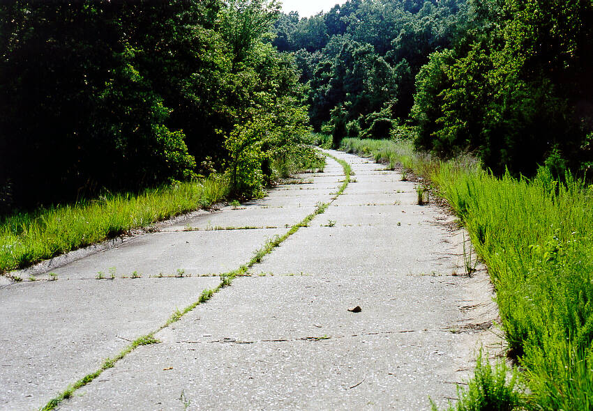
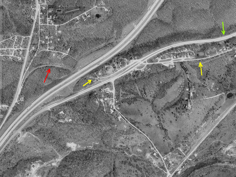 East of St. Robert MO two Route 66 alignments meet I-44 near exit #163, west of Devil's Elbow. On the far left is a photo of the older two-lane alignment as it extends west up the hill from the Interstate. You can see the concrete half-curbing on the left side of the road. The aerial view at the near left shows this two-lane alignment (in red) nicely. It extends across the Interstate and east (in yellow) on its way to Devil's Elbow. The newer four-lane bypass 66 is marked in green.
 I had heard the term "disappearing service station" but I never thought that I would catch one in the process. Near Halltown, MO we have pumps, a truck to be filled, and a Texaco sign, but no building, at least that we can see. So my theory is that the largest structure is the one to disappear first. I'll check back later to see what disappears next. In the meantime, I'll contact the Nobel selection committee concerning my theory.
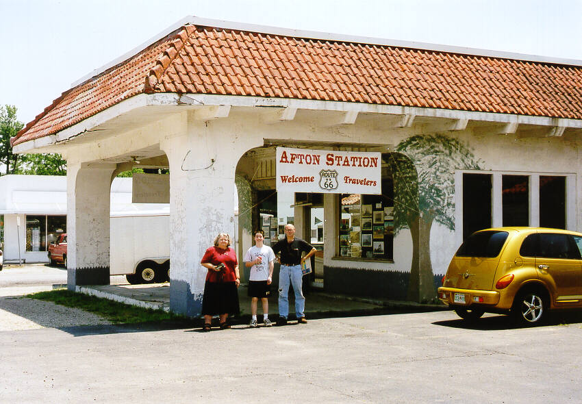 We had a delightful visit with Laurel and David at their Afton Station. They are restoring it, and they have several antique autos on display. And here is the group photo.
 Since 1997, our first tour, I have wanted to preserve this on film. So it is June 2002 and I am only five years late.
 A rare treat awaited us one block south of 66 in Erick, OK, on Sheb (One-eyed One-horned Flying Purple People Eater) Wooley avenue. Here are Harley and Annabelle Russell, two delightfully zany self-proclaimed "Mediocre Music Makers". After they serenaded us for a while in their Sandhills Curiousity shop, I managed to threaten and bribe Ryan to wear a hat and join the Russells for a photo. Look carefully at his smile. It shouts "get me out of this!!".
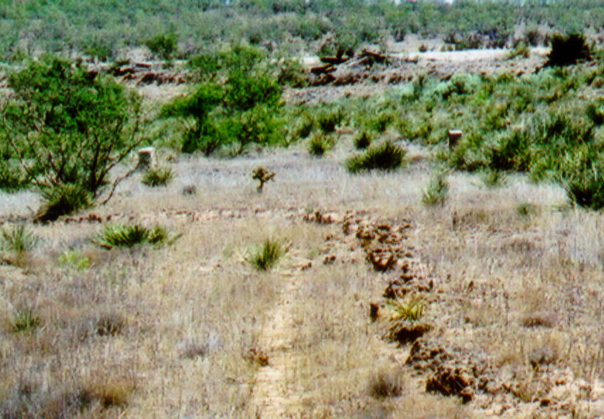 From an examination of aerial photography, I suggested to Jim Ross and Jerry McClanahan that an old alignment of 66 extended north of I-40 west of Adrian, TX, at the edge of the caprock. Here is some of the evidence for this as seen from the Ivy Road exit west of the Gruhlkey place, and north of the Interstate. You can see the road scar in the thumbnail at left. It is difficult to see the concrete culvert and the ruins of the C.R.I.& P. RR tracks in the thumbnail, but if you click on it, you can see the enlarged version.
 I know, I know. There are a bazillion pictures out there of the Blue Swallow in Tucumcari, NM. But this one is the best. That's my story and I'm sticking to it.
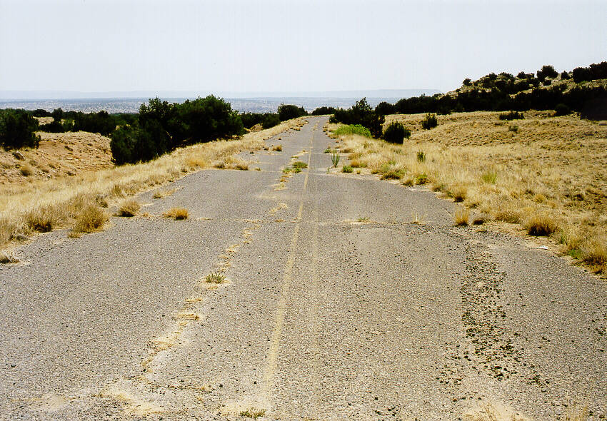
 About a mile east of Newkirk, NM an old alignment of 66 (in the background, just above the middle fencepost) emerges from south of I-40, crosses the Interstate, and then extends under my feet.
 In the Spring 2002 issue of the National Historic Route 66 Federation News, Mark Potter mentions the Hubbell Motel on West Central Avenue in Albuquerque, NM. This sign is all that remains. Surrounding it is an open field.
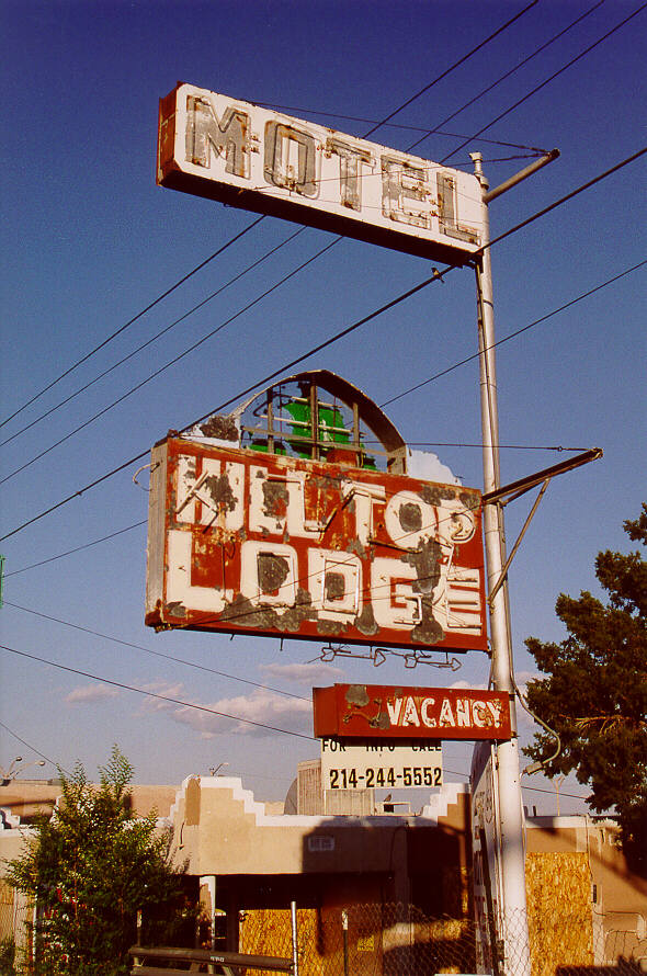 There are many complex and interacting factors that surround the decline of any commercial enterprise: social, political, demographic, economic, perhaps even meteorological. But I believe that I have distilled the very essence of that which caused the foundering of the Hill Top Lodge in Albuquerque - it is not located at the top of a hill.
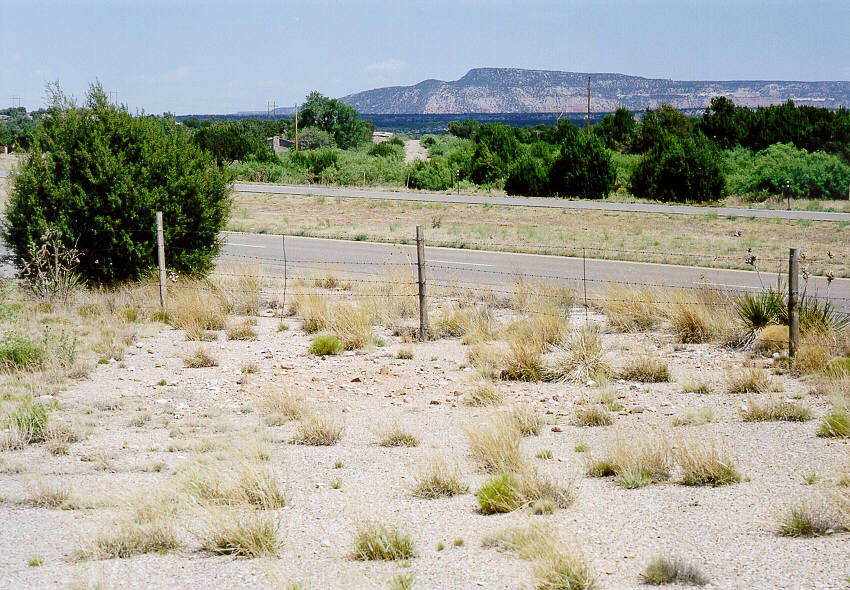
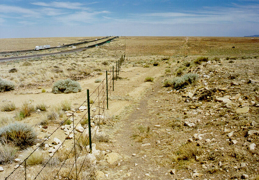
 Immediately east of I-40 exit #114 east of Laguna, NM a strip of pavement branches from 66 eastbound and hugs the Interstate. An older alignment of 66?
And on July 19, 2002, comes the clarification from the Pathfinder:
"I noticed you had a question mark with your caption to the photo near Laguna as to whether the road ruin pictured was 66. Answer--yes. It was an upgrade alignment to the winding road around the mesa via Owl Rock, and was later clipped and absorbed by I-40 right where it dropped down the escarpment. Next time there, check your westbound line of sight from where the road curves just past Owl Rock and you will see that the road you're standing lines up with the top of the hill right where that scrap of road remains. Ironically, the older alignment outlasted it's replacement and survives today." Thanks JIM ROSS!
 Near Bluewater, NM, an older alignment of 66 was located north of the RR tracks paralleling newer 66. You can find route 66 bridge ruins like this one. You can view these ruins from the newer alignment by looking through the RR bridges.
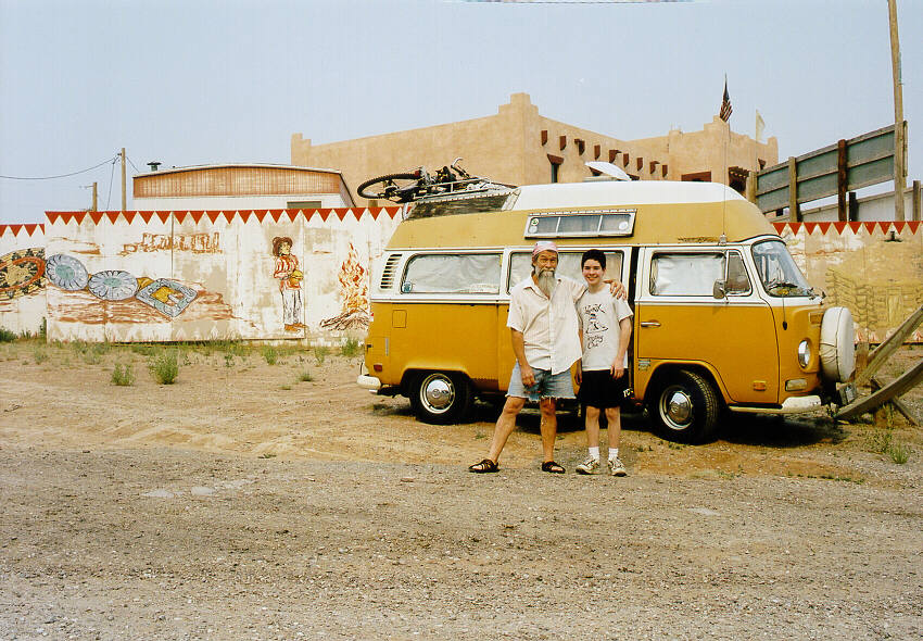 Amazing. This is the third time that we have encountered Bob Waldmire on the road, quite by chance. Here were are at Indian City AZ.
 The next I-40 exit west of Two Guns, AZ is Buffalo Range. This is view to the east, about a mile west of the exit. At the top of this hill, you can see old 66 extending eastbound to the horizon. 66 here is crumbled pavement with some concrete culverts. It merges into I-40 just beyond. And back under my feet, it merges also into I-40 westbound, reemerging at Twin Arrows. You can see my dark blue truck near the top right of the enlarged view. Ryan chose to sit this one out.
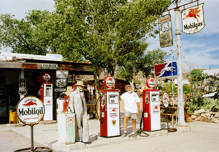 This year, we timed it correctly to get to the Hackberry Visitor's Center & General Store before it closed. We had a relaxing conversation with John Pritchard, who has amassed an impressive collection of Route 66 items. This place is a must-see.
... and the 1997-2000 Tours are here.