Before we attempted Tikaboo Peak, we sought sage counsel from Glenn Campbell - Area 51 Guru and self-confessed UFO disinformation agent. 66:51
Would YOU believe any disinformation from this guy? Seriously, we had a nice visit with Glenn, who was kind enough to join us for a short-notice buffet. 66:51
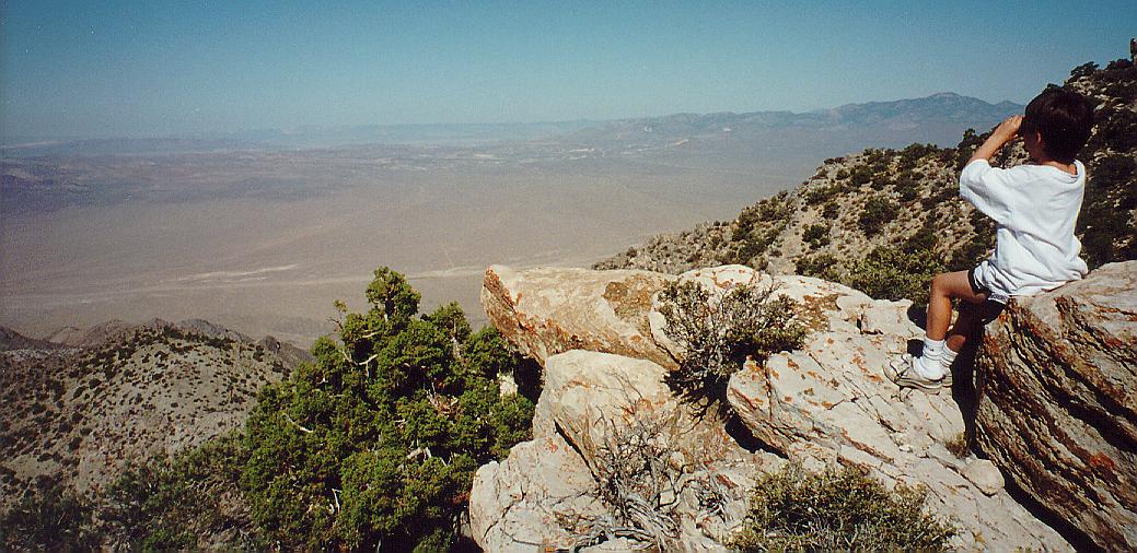
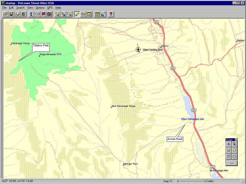
We made it up to Tikaboo Peak after a two-hour climb, thanks to the 'disinformation' found in the Area 51 Viewer's Guide. The climb is as difficult as Glenn and Tom Mahood caution. We also used a Street Atlas V4 map to help us stay on the correct "road" to Tikaboo Peak.
Actually, this is a side-summit of Tikaboo Peak, but one can see into Area 51 quite well from here. From this vantage using 10-power binoculars, we could see Area 51 hangars, aircraft, and a very looooooong runway, not visible in this photograph. In the valley foreground we could see many roads criss-crossing, leading, it seemed, only to each other. We could see Groom Lake road until it was obstructed by the mountains.
A very interesting phenomenon occurred as Ryan and I were headed up the mountain. We could hear the roar of high-performance aircraft nearby, but we could catch only a brief glimpse of one high overhead. Then, as we approached the side summit, all such sounds stopped, only to retun when we left Tikaboo Peak. Coincidence?
Standing at the peak, and gazing into Area 51 reminded me of the tune Cage of Freedom from Giorgio Moroder's realization of the otherwise silent movie Metropolis (and the re-release) ...
Cage of Freedom, that's our prison. We're the jailer and captive combined.66:51
Cage of Freedom, cast in power, all the trappings of our own design.
Blind ambition steals our reason. We're soon behind those invisible bars.
On the inside, looking outside, to make it safer we double the guard.
Cage of Freedom, there's no escaping. We've fabricated a world on our own.
Cage of Freedom, that's our prison. We fabricated this world on our own.
World on our own
World on our own
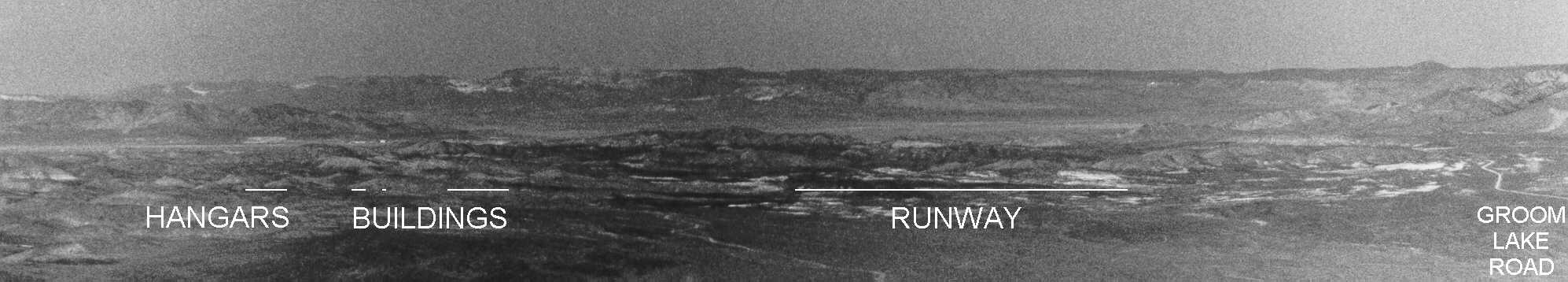
Although I had not planned to secure detailed pictures of the facilities at Area 51, I noticed that there was more information on the 35 mm negative than I thought. The airbase extends horizontally in this view, in the middle of the frame, just above the foreground mountains and the lines and text I added, and just below the background mountains.
Other folks have secured much, much more detailed pictures. The B&W image below shows the area just above the letters "BU" in my image above. If you click on the thumbnail below, the link will take you to the full version. An even more detailed, color image was obtained from the foreground mountain ridge closer to Area 51, a ridge now closed to the public. It too is a thumbnail, and clicking within it takes you to the full version. Please note that these images are copyrighted by Steve Hauser. 66:51

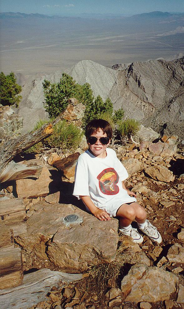
We have reached the true summit Tikaboo Peak here - there is a surveyor's marker set in the rock on which Ryan sits. 66:51
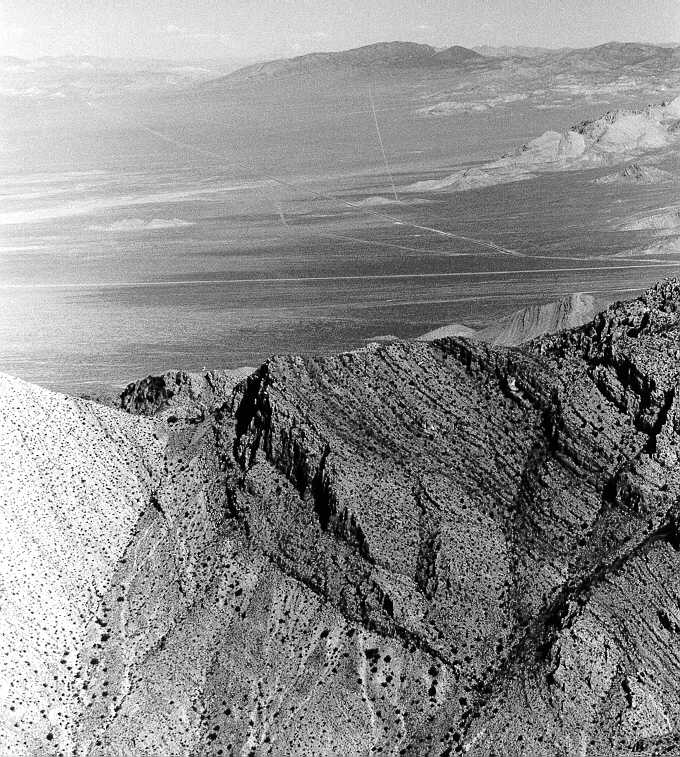
Groom Lake Road extends horizontally in this photograph, just above the foreground mountains. The ET Highway, NV 375, intersects Groom Lake Road just out of the frame on the right. It then turns northwest to Coyote Summit, and beyond to Rachel, our next target. 66:51