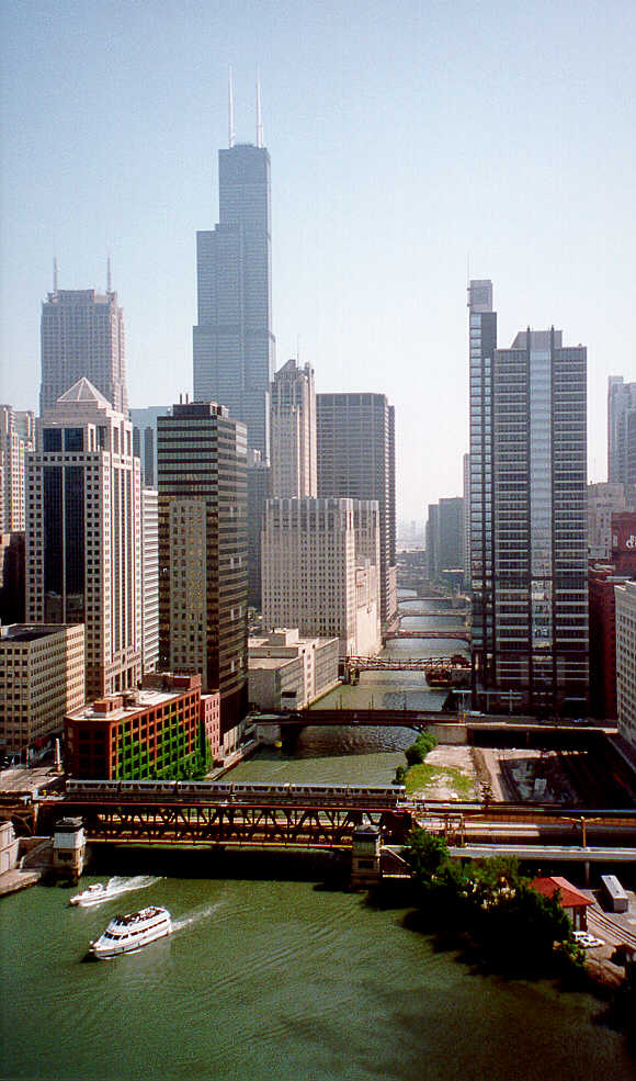
In Chicago, the Sears Tower reaches to the sky and overlooks our starting point on Route 66. In the distance, the sixth bridge across the Chicago River is Adams - Route 66 westbound.
This is the only Holiday Inn I stayed in that had the Disney Channel. We walked for miles, drank water, and saw a person dressed in bright yellow. I thought the bees would get her. 66:51
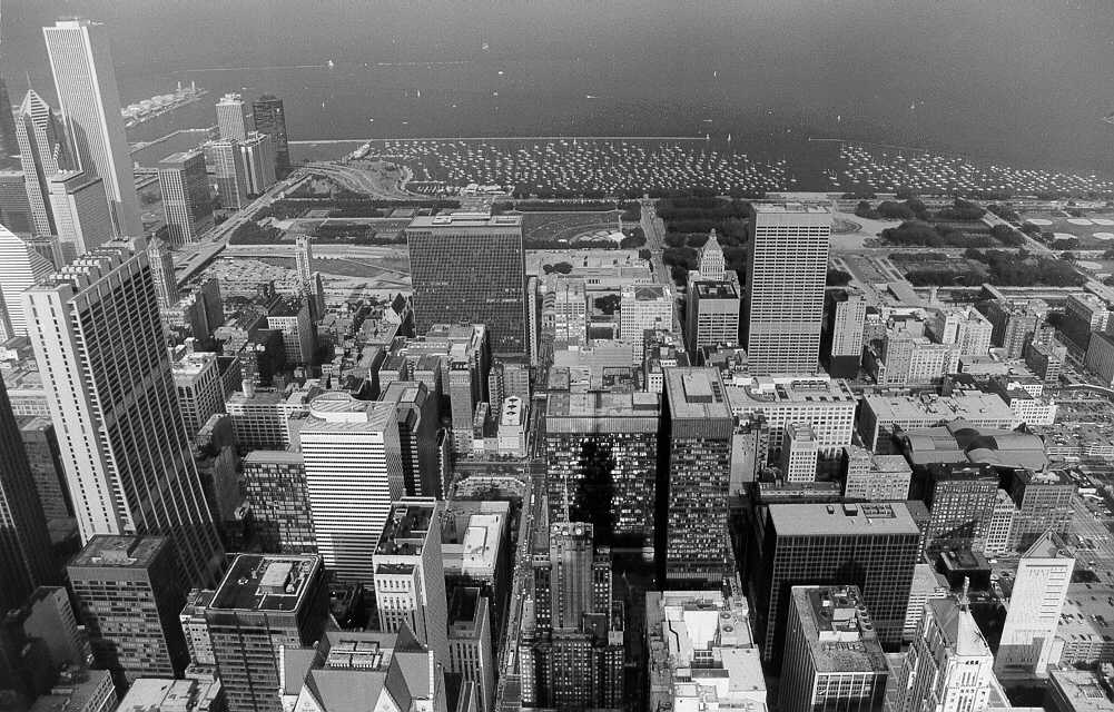
We arrived in Chicago early in the hot afternoon, checked into the hotel, and began exploring. We took a ride to the top of the Sears tower, where Ryan took this picture. The view is east towards the lake. Adams is left of centerline, ending at the art museum on the western edge of Grant Park. Jackson is on the right, extending to Lakeshore. 66:51
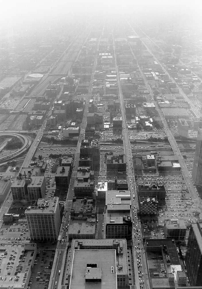
Looking west, Adams is now right of centerline, Jackson is on the left. Even with a red filter, the camera could not record the scene all the way to the horizon due to the late-afternoon haze. 66:51
Walking around the loop area, we found this sign on a pole at Jackson near Columbus, adjoining Grant Park.
For some years, I was confused about the exact start/end of 66 in Chicago. But thanks to Dave Clark, resident "Windy City Road Warrior", we have the facts.
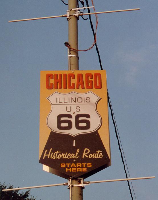
There is a sign on Adams street just west of Michigan Avenue, one of the familiar brown-and-white "Historic US 66" markers, which has the word "Begin" on top of it. It's quite photogenic, and if you take the photo properly you can see the Sears Tower behind it. I'm glad it's there.THANKS DAVE !! 66:51
Only problem is, 66 NEVER began at Adams and Michigan.
There were two spots in Chicago where 66 began its westward run. In the 1920-middle 1950s timeframe, Jackson Boulevard was a two-way street, while it is now one way eastbound. So, in 1926 the westward run began at Jackson Blvd and Michigan, one block south of where the Begin sign now stands. Of course, this is not a good place for a street sign, since it would face away from traffic, but it would be a fine place for a historic marker to inform pedestrians of the importance of the place.
In 1926, Michigan avenue was US 41, so the intersection of Jackson with Michigan was also the intersection of 41 and 66. In 1937, US 41 was moved completely off of Michigan to what is now known as Lake Shore Drive, which is parallel to Michigan Avenue, two long blocks further east. So, the terminus/beginning point of 66 was extended east on Jackson to meet it.
When Jackson was changed to one way east in the middle 1950s, the portion between Michigan and Lake Shore Drive remained two-way (as it still is to this day). The westward beginning remained at Lake Shore Drive, and the alignment followed Jackson west to Michigan, then went one block north on Michigan, then west on Adams.
So, even though the "Begin" sign is not accurate, it is all we currently have. (There is a matching "End" sign on Jackson, which is at least accurate for the 1926-1937 period). There used to be light- standard banners on the poles west of Lake Shore in the early 1990s, but they vanished years ago.
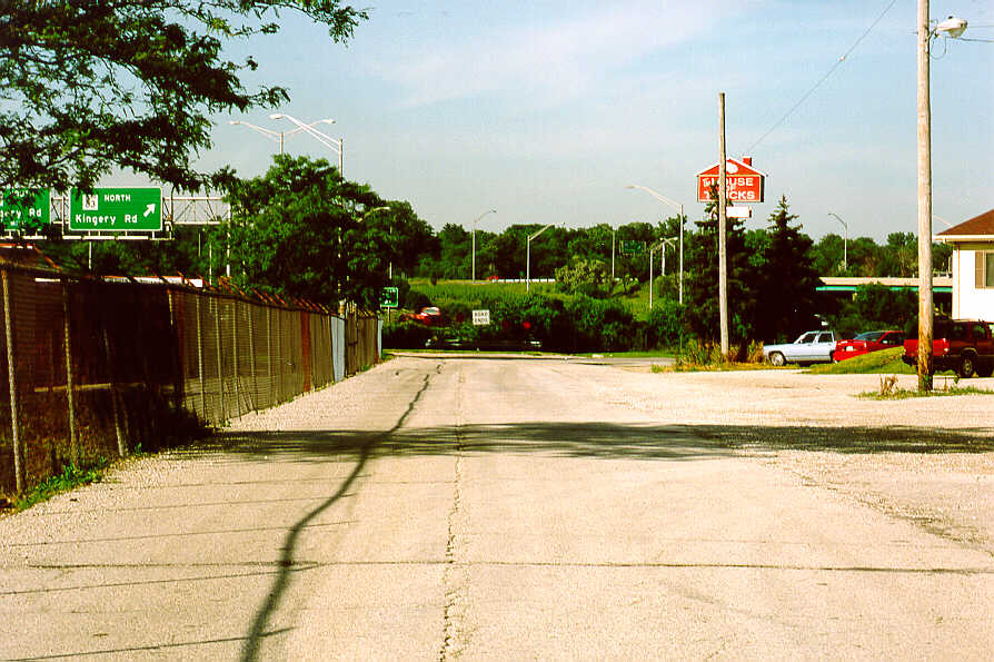
In several places on the north side of I-55 between breaks in Joliet Road, the frontage road is old Route 66. This section is at the Kingery Road exit of I-55. 66:51
Just south of Joliet, IL, the four-lane in the background peels away from an earlier alignment (South Chicago road, north of Elwood) in the foreground. We found many of these scenes repeated along Route 66. 66:51
Ryan, in standard clown-mode, receiving a much-needed (and, from my perspective, much-appreciated) headlock at the Launching Pad in Wilmington, IL.
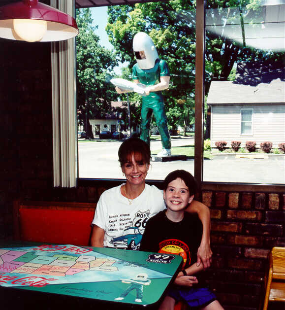
I never knew a cafe would have anything to do about aeronautics. We bought a keychain here. 66:51
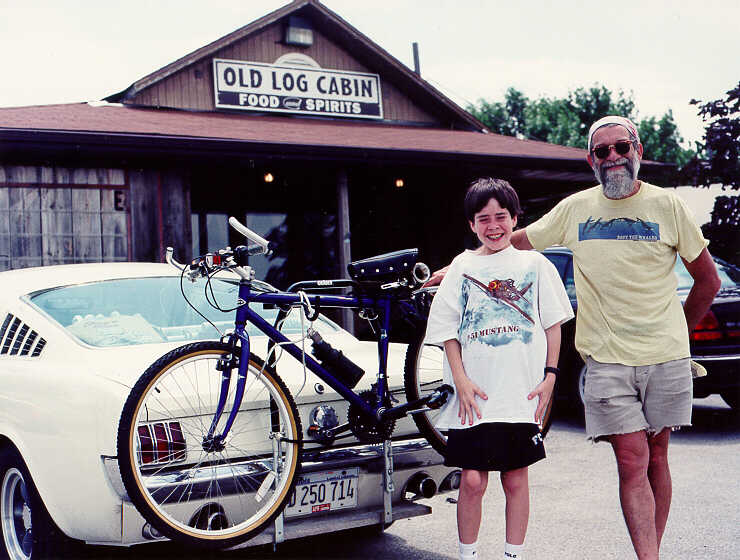
During our summer 2000 tour, Ryan and I turned northbound at the southern end of Dwight, IL, to check out the early alignment of 66 now called Odell Road. Just behind us was a white Mustang, whose driver waved to us as we turned north. Now let's examine this. This driver knew that we were roadies: what else would two characters in an SUV with PA plates be doing in IL, on this alignment? And we knew that this driver was a roadie - acknowledging us. So after exploring Odell Road, I returned southbound, passed the Mustang, and as we approached Pontiac (IL, not the car), I motioned the driver to turn left at the Old Log Cabin. Sure enough, we had chanced upon Bob Waldmire. We had a brief chat with him, and he and Ryan posed for this picture. Unfortunately, I believe that the shutter caught Ryan in mid-sneeze. 66:51
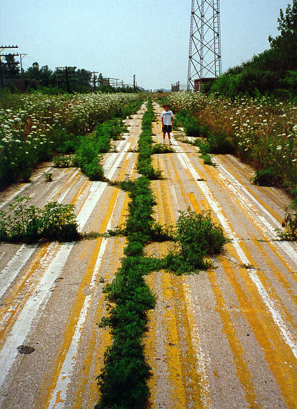
Nature is trying to reclaim this unused alignment, the southern-most extension of Ladd street in Pontiac, IL. Either this section was used to test paint, or the people in charge here are reluctant to bid farewell to the late '60s. Looking for fun and feeling groovy.
That piece of Route 66 looked like a three hundred year old overgrown piece of road. 66:51
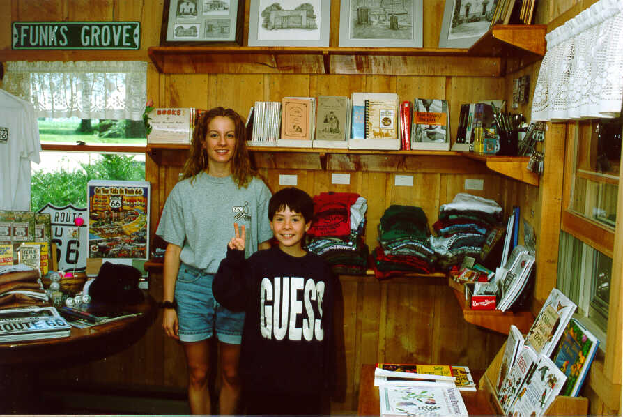
Ms. Betsy Funk continues the family tradition by helping us choose some valuables at their store near Funk's Grove, IL.
66:51
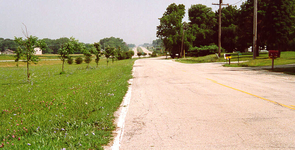
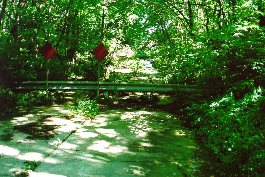
Another pre-four-lane section of Route 66 can be found north of Elkhart, IL.66:51
Leaving Springfield, IL, you can take the Toronto Road exit east from I-55. A right turn (south) on Cotton Hill Road will take you to the barricaded end of Route 66 where it encounters Lake Springfield. You can see the water just above center in the photo. We found this section using the directions given in an issue of Federation News, published by the National Historic Route 66 Federation. 66:51

We were south of Springfield, IL - and one of the many places where Route 66 parallels the interstate. There was a ten-mile backup southbound on the interstate, but we sailed on by it on Route 66.
That road was always bumpy. 66:51
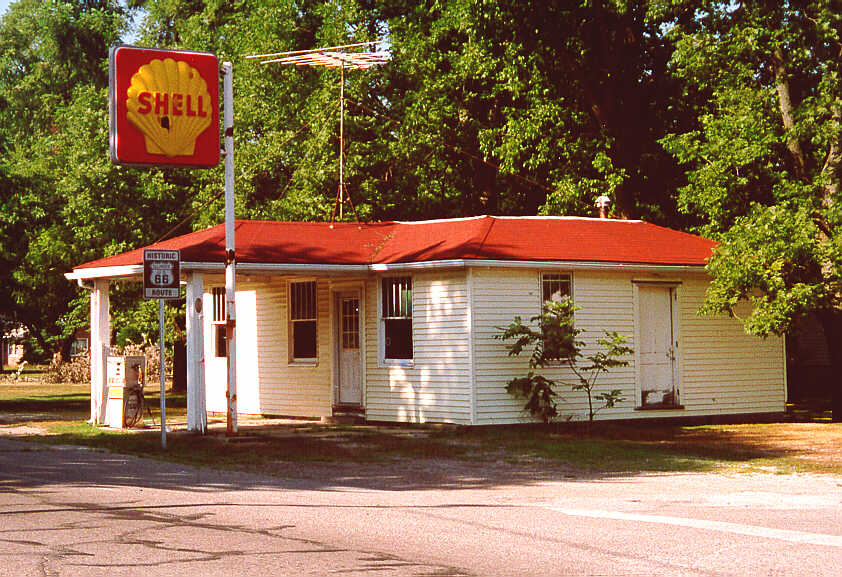
Soulsby's Service Station in Mt. Olive, IL: in service from 1926 to 1992. I cannot even imagine. I stopped to take this picture, taking my time to get the best angle on the sun. A couple in an old pickup truck was stopped eastbound at the sign just outside the view, on the left. Not wanting to intrude, they waited several minutes at the stop sign until they saw that I had taken the photograph. We waived to each other as they drove past me. Another Route 66 story. 66:51
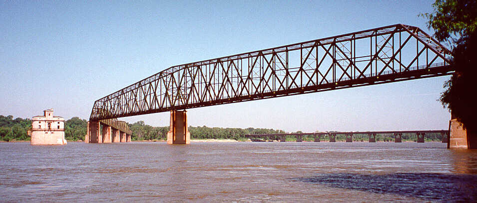
We found the Chain of Rocks Bridge over the Mississippi after some creative navigation. Basically, if you follow the signs, however counter-intuitive they may appear, they direct you to Chain of Rocks Road, over a bridge across a canal, and to a "barrier". A left at the barrier onto a dirt road leads to the waterline. From this vantage, one can see the bridge and its unusual turn to the right.
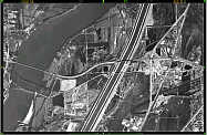 Here is an aerial view of this region. Click this thumbnail for further information. 66:51
We played battleship. We put sticks in the water - the bigger the stick the bigger the ship. Then we tried to sink the ships by throwing stones at them. The sticks would shatter, break, and sometimes sink. The water carried the broken ships downstream. This was the oldest bridge I ever saw.
The half-hearted barrier (about 100 meters behind us) attempting to thwart our search for the eastern bridge approach was no match for the ER-4A rural assault vehicle. 66:51
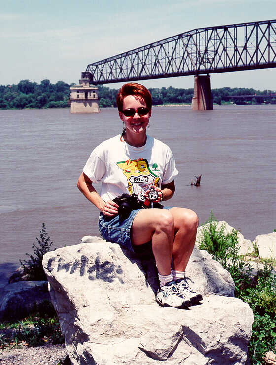
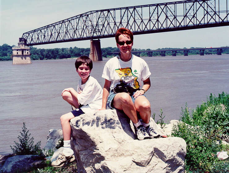
In June 2000, Shellee met us at the Chain of Rocks bridge for a photo shoot. Here is Shellee perched on a rock, trying to get away from Missie, the Mississippi River Monster (in the background on Shellee's left). Missie is believed to be genetically related to Nessie, the Loch Ness Monster.
Shellee is best known for her work in photography for the exhibit "Return to Route 66: Photographs from the Mother Road", and she is the author of "Tales from the Coral Court: Photos and Stories from a Lost Route 66 Landmark". You can find more about this gifted artist here.
After Ryan chased Missie away with a few colorful Scottish metaphors and threats of pyrotechnic armageddon, he got into the picture. Ryan and Shellee and Missie, oh my!